
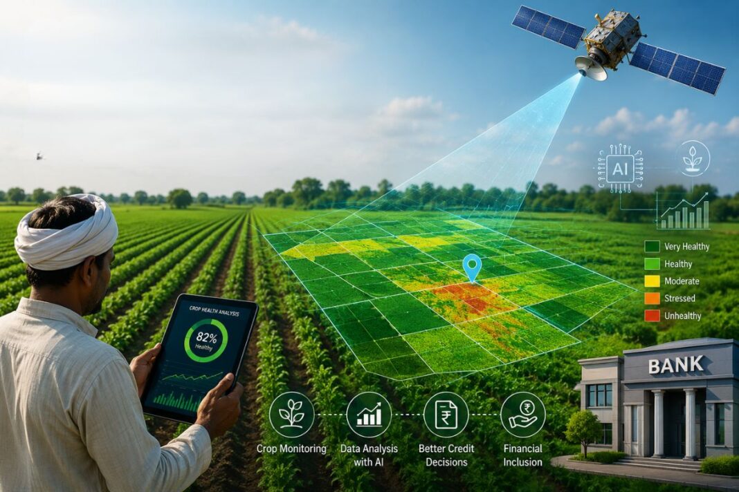

The loan that took fifteen days now takes thirty minutes, and the reason has nothing to do with paperwork moving faster or banks hiring more staff. It has to do with satellites monitoring Indian farmland from space, assessing a crop’s health the way a doctor reads a pulse, and relaying that information to lenders before a farmer even finishes filling out a form.
For generations, borrowing money to plant a crop meant enduring a process built almost entirely on waiting. A farmer walked into a bank branch carrying land papers, a rough plan of what would be sown, and whatever identity documents the clerk demanded that year. A field officer then had to travel out to the plot, confirm the land was actually farmed, note what was growing on it, and estimate what it might yield. In parts of rural India, this would take ten to fifteen days, sometimes longer. During the narrow sowing window that decides an entire season, a delay of even a week would mean missing the moment when seed, fertiliser and water all need to come together.
That waiting period is now collapsing. A new class of lenders can pull up satellite-based farm intelligence and know within minutes whether a plot is under cultivation, what crop typically grows there, how it has performed in the past seasons, and how exposed it is to drought or flood. A credit officer no longer waits for a field report scribbled by hand. They look at a screen, see a picture of the farm built from years of orbital data, and approve the loan before a visit would even have been scheduled under the old system. For the waiting farmer, this is the difference between sowing on time and losing a season, between feeling shut out and feeling, for a change, that the system works for them.
How a Satellite Reads a Field
Earth observation satellites continuously pass over Indian farmland, recording images across bands of light that the human eye cannot register. By applying remote sensing methods and vegetation measures such as the Normalised Difference Vegetation Index, analysts can tell how vigorously a crop is growing, whether it is short of water or nutrients, and how its green cover shifts from one week to the next.
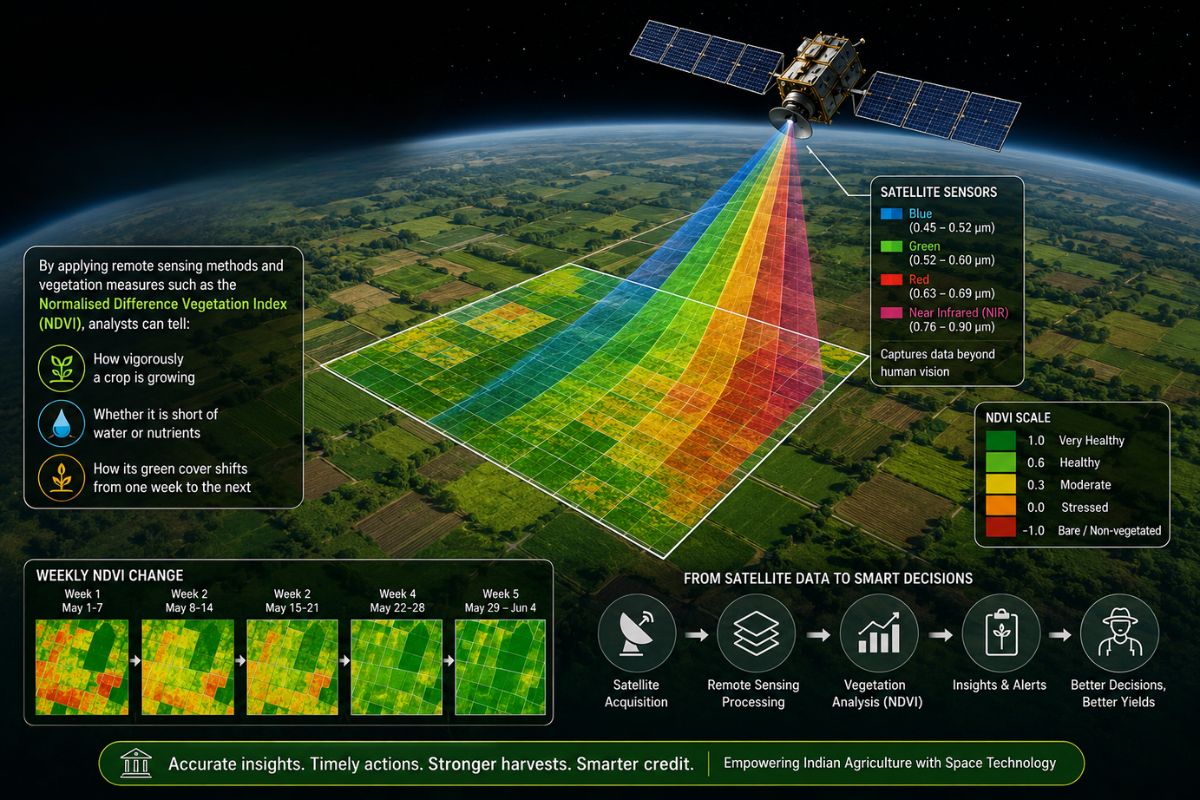
Companies such as SatSure draw on open data from missions like the European Space Agency’s Copernicus Sentinel programme and ISRO’s Bhuvan portal, then layer in weather patterns, soil records and ground reports. Algorithms sort out which crop is growing, when it was likely sown and harvested, and how its yield compares with expectations. Where a bank once had a single snapshot from a single visit, it now has a running record of the farm’s behaviour over several years, covering acreage, plant health, past output, access to irrigation, and exposure to erratic weather. What once trickled in slowly through scattered field visits now arrives as a report that a bank can access in seconds.
A Digital Copy of Every Farm
Among the companies pushing this idea forward, Bengaluru-based SatSure has built what it calls digital twins of farmland. These ongoing virtual models mirror real growing conditions using satellite imagery, weather patterns and agronomic detail. For each plot, it tracks cropping cycles, sowing and harvest timing, plant health, and yield across the Kharif, Rabi, and summer seasons, going back through past years, and factors in rainfall, temperature, and groundwater levels along the way.
From this stream of information, SatSure produces something like a credit score for the land itself, delivered through tools it calls Sage- aimed at lenders, and Sparta- aimed at tracking a crop through its life cycle. The company does not lend money. It sells insight to banks, insurers and government bodies, who use that insight to decide who gets credit and on what terms.
A farmer’s case no longer rests on one officer’s impression of a single visit. It rests on years of recorded behaviour of the land. Because plots are mapped and tied to a running timeline of satellite images, a bank can confirm within moments whether a field is active and what stage the crop has reached. A farmer who has never held a loan before, who has no paper trail a bank would normally ask for, can still be judged fairly because the intensity of cultivation, the presence of irrigation and the history of yield stand in for the credit history they never had the chance to build.
Why Speed Has Made Lending Fairer, Not Riskier
Agricultural lending has always been caught between two opposite worries. Banks fear lending against land they cannot properly verify, and genuine farmers fear being turned away because they cannot prove what their land can actually do. Satellite monitoring eliminates both problems at once.
With a continuous view of farmland, a lender can track an entire loan portfolio with a level of detail never possible before, seeing which districts are thriving, where drought is taking hold, and which borrowers might struggle to repay before that struggle turns into a default. That kind of early signal lets a bank step in with a restructured loan or timely advice, rather than discovering the problem only once repayments stop. It also removes much of the need for repeated manual checks, which is largely why processing time has fallen from roughly two weeks to under half an hour in several pilot programmes, with some firms arguing bad loans could fall by as much as forty per cent as approvals rise for farmers previously screened out for lack of paperwork.
The gains run in both directions. Farmers get quicker access to money and a fairer shot at credit, even without a formal financial history, along with earlier support when their crop runs into trouble. Banks gain lower costs, faster decisions and underwriting records that hold up under scrutiny. Both sides end up looking at the same evidence, drawn from the land rather than filtered through guesswork.
A Quiet Shift Spreading Across Rural India
This is not confined to one company or one state. State governments, development institutions and private firms are working together to fold satellite intelligence into farm credit and crop insurance. Uttar Pradesh, for instance, has partnered with the International Finance Corporation to bring satellite-based lending to the state, drawing on scoring models from SatSure and Dhruva Space. Elsewhere, platforms such as AgriBhumi and AgriBazaar are building similar digital farm profiles.
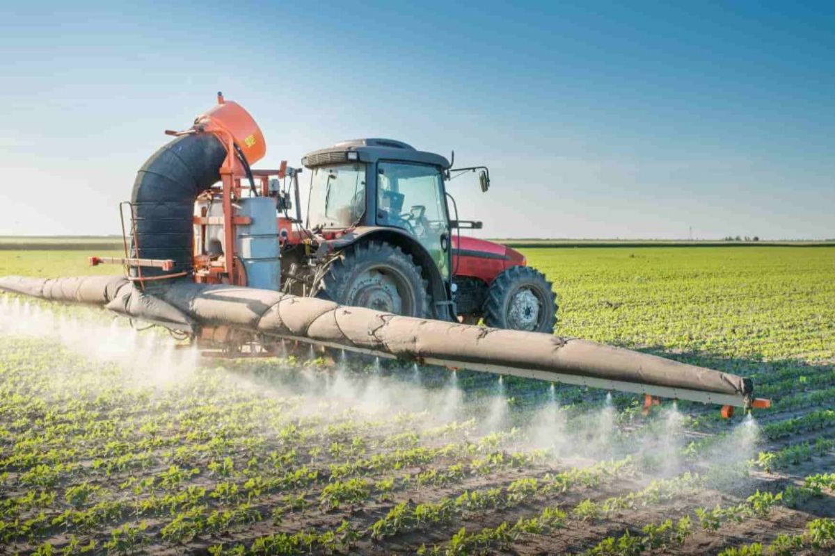
A change picked up in the vegetation over a cluster of fields can now trigger several things at once: guidance for the farmer, a warning for the lender, and a note of concern for the district office. Technology built to orbit far above the planet now bears on the furrows of small plots in Vidarbha, in Bundelkhand, along the coast of Andhra Pradesh, helping a farmer decide with more confidence whether this is the season to sow.
What This Really Changes
None of this is really about satellites or algorithms. It is about whether rural India can trust the systems meant to serve it. For too long, seeking a loan meant handing over land a farmer understood intimately to a process that trusted paper over lived knowledge. Now the land itself supplies the record, season after season, in a form a bank can actually read.
The challenges have not disappeared. Patchy internet access, uneven digital literacy, questions about data privacy, and the need for a proper way to appeal an incorrect decision remain real concerns. But the direction looks encouraging. A farmer in a remote village can walk into a branch, share the coordinates of a plot, and watch a loan get approved in roughly the time it takes to finish a cup of tea, because the bank has already seen that field from above.
India’s earlier agricultural transformation was driven by better seeds, expanded irrigation, and improved farming knowledge. This one runs on trust built from data gathered quietly overhead. Satellite technology, applied carefully to the realities of India’s seasons and soils, is helping ensure credit reaches the people who need it when they need it. For millions of farmers, that could mean not just getting through one more season, but building toward a future with a little more security in it.
Also Read: Nolan’s The Odyssey Pushes Cinematography to New Limits
You can connect with DNN24 on Facebook, Twitter, and Instagram and subscribe to our YouTube channel.